Besseggen Ridge, Norway
Andrew Mazibrada
Besseggen Ridge, in the Jotunheimen National Park, is the most popular day-walk in Norway. The views from the ridge, in all directions, are breathtaking and unique. Here, Andrew Mazibrada describes the best ways to enjoy this famous ridgewalk.
The Land Of Giants
Jotunheimen, the Home of Giants, replete with legends of trolls and monsters eons old, has an atmosphere all of its own. It is a beautifully distinctive and rewarding experience. To get there, you’ll need Oslo Gardermoen airport. The drive to Gjendesheim takes around four hours from Gardermoen and, in the middle of the night, traffic is virtually non-existent. For much of this majestic journey you will be accompanied by huge lakes of sublime beauty, framed by delightful forested hills. Public transport is also possible in form of the train to Otta on the Dovre line, and several buses into the park itself. Flights to Oslo are not particularly expensive if booked well in advance, but hiring a car is – in fact, everything in Norway is pure extortion, which is little exaggeration. Budget carefully as you’ll inevitably spend more than you think. Find out more at http://www.visitjotunheimen.com.
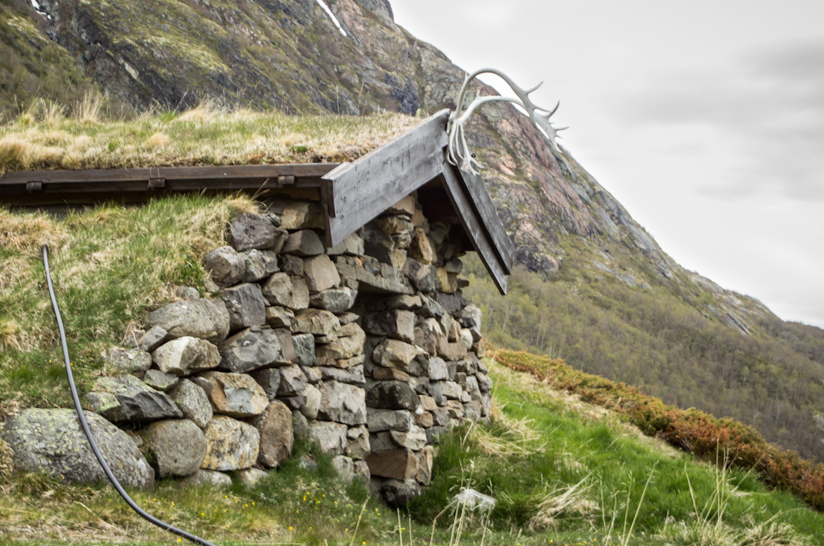
THE HUTS
The huts at Gjendesheim, Memurubu and Gjendebu open around mid-June and close mid-September. The Gjendesheim Hut staff itself are an excellent source of information and welcome emails ([email protected]). The timetable for the Gjendesheim-Memurubu-Gjendebu ferry is a study in obfuscation (http://www.gjende.no) but they can be emailed too and during the peak season ferries are relatively regular.
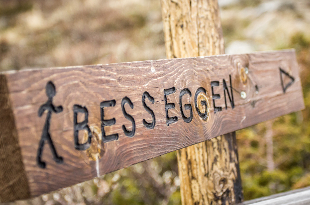
THE RIDGEWALK
The start of the Besseggen Ridge walk is Gjendesheim on the edge of Lake Gjende. Much of the high road into the snow-adorned Jotunheimen also bestows wonderful vistas across glaciated Norwegian landscape. At Gjendesheim, the DNT flagship hut is is an excellent place to spend the night before your walk if you need to. There is a small kiosk by the Memurubu/Gjende ferry where very limited provisions can be purchased as well as some pleasant morning breakfast buns. As I’ve said, everything is expensive in Norway and here even more so.
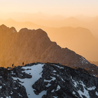
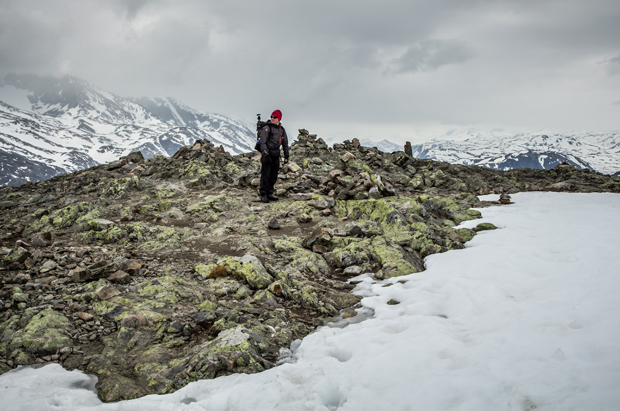
The trail leading onto the Besseggen Ridge (designated JOT2) is marked by the small DNT symbols, a blood-red ‘T’ painted in red on rocks and periodic cairns. Initially, the man-made trail up to the ridge is straightforward but tortuously steep. As the vista opens up, sleek, shark’s fin ridgelines rise up from the shores of Lake Gjende and you will begin to appreciate the allure of this hallowed place. From time to time, early or late in the season, you may we encounter snow, usually only a hundred metres or so of it at a time, but it is flat and usually easy to traverse or avoid. It’s not crampon territory but often not very far off. Stay on rock where you can. From time to time, hands on scrambling is necessary but not such as would require protection.
Eventually, the ridge begins to flatten out and the rocky plateau of the first part of Besseggen stretches out before you. The edge of the ridge leads to a sheer drop of hundreds of metres into Gjende below. There are cairns to guide you but if the mist descends, you’ll find it hard to see them.
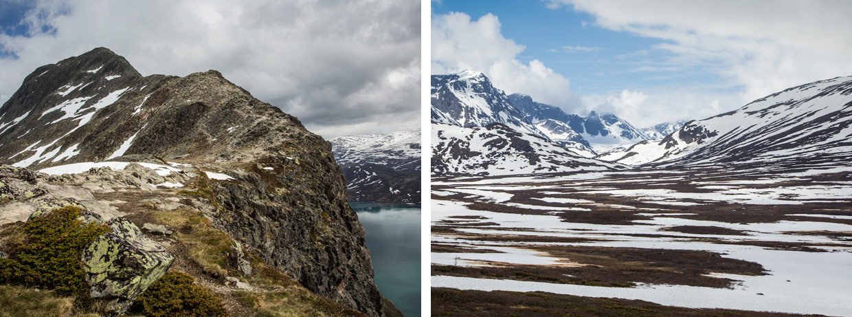
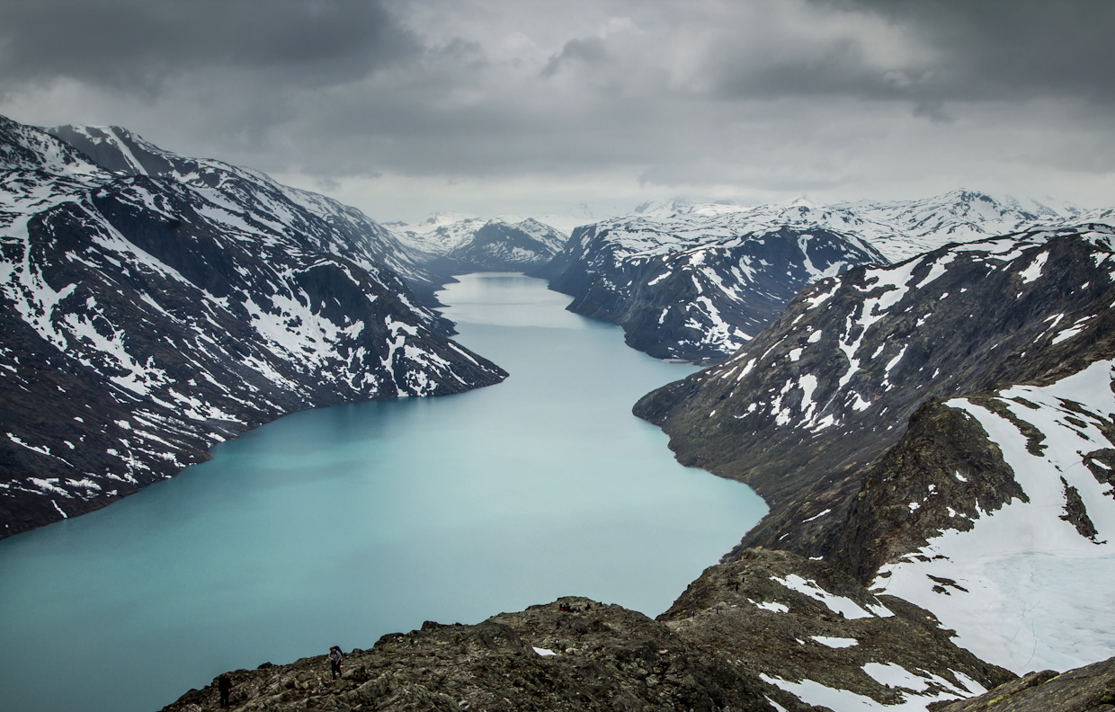
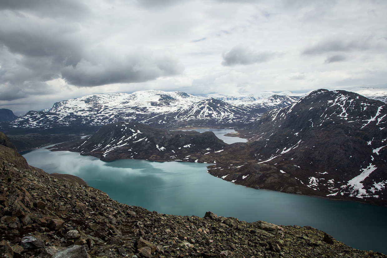
One of the most astounding things about Besseggen is the almost fluorescent colour to the moss-laden rock – all vibrant greens and yellows. The final summit cairn of the ridge – a huge pyramid at Veslfjellnet (1743m) – gifts views across, not only to the end of the Gjende, but also the Russvatnet and Bessvatnet, which are just as beautiful. It’s impossible to avoid comparing the difference in colour, a consequence of glacial run-off, between Gjende and Bessvatnet. Jotunheimen has a true wilderness feel that simply does not exist in the UK outside of the highlands of Scotland and your destination now is Memurubu, a small area on an inlet in the bottom of a valley between mountains on the shores of the Gjende housing a privately owned hut.
MEMURUBU OVERNIGHT
As you descend from the summit cairn towards Bandet, a short ridge at the foot of Besshø, and on the shores of Bessvatnet, you will begin to see why Besseggen is graded as a ‘difficult’ walk. The descent on the knife-edge ridge is genuine scrambling. From Bandet, you will delight in the views across Bessvatnet before ascending again, albeit this time in short ups and downs. Pass through the shadow of Besshø and you begin the final, steep descent into Memurubu and your overnight camp. The Besseggen walk is 6-8hrs according to the DNT and that’s a solid estimate. Break regularly for photography and to eat, and you’ll take 7 hours. Memurubu has a large hut but also places to camp if you wish.
AN ALTERNATIVE ROUTE AROUND RUSSVATNET
Alternatively, instead of taking the path along the shores of the Gjende back to Gjendesheim, it is possible to circumnavigate the Russvatnet by ignoring the path down to Memurubu and heading north along the trail to Glitterheim (JOT21) and later cutting across to the Glitterheim-Gjensdesheim trail, JOT3, the meeting point of which is located at GPS co-ordinates 61.572522 (+61′ 34′ 21.08″), 8.690786 (+8′ 41′ 26.83″). Then head south-east back to Gjendesheim. There are plenty of places to wild camp in Jotunheimen, particularly on the shores of Russvatnet.
HEADING BACK TO GJENDESHEIM
If you choose to camp/stay in Memurubu, then you’ll need to find the unmarked trail along the shores of Gjende. It is not an easy path, winding up and down the mountainside – poorly kept in places and exposed in others, it looks on the map for all the world to be an easy 3-4 hour stroll – be warned, it requires work and no little concentration but the views from here across the Gjende are superb. From the mirrored surface of Gjende you are gifted a different perspective of Jotunheimen than from the ridge of Besseggen. You will come across two pebble beaches, right against the Gjende, with more than enough room to camp and pitch a tarp or the fly of a stand-alone shelter. Depending on your fitness, these may be alternatives for the night instead of Memurubu. Arriving back at the Gjendesheim hut, you can then travel back to Oslo.
EQUIPMENT
Weather changes dramatically and quickly so be sure to pack for poor weather even if the forecast is for settled weather. Many hikers have been caught out by erroneous weather predictions from the Norwegian weather organisations. Remember not to take camping gas with you but source it en route. Gas cannot be taken even into the hold of an aircraft. You can find a free downloadable PDF called Safety in the Norwegian Mountains here.
The best guidebook, in my view, is published by Cicerone, authored by Constance Roos, and is called “Walking in Norway” – although old now (1998) it is due to be updated soon, I am told. The best map is the Nordeca Turkart 2643 1:25,000 entitled “Besseggen”.