
Annapurna Sanctuary Guide
Survive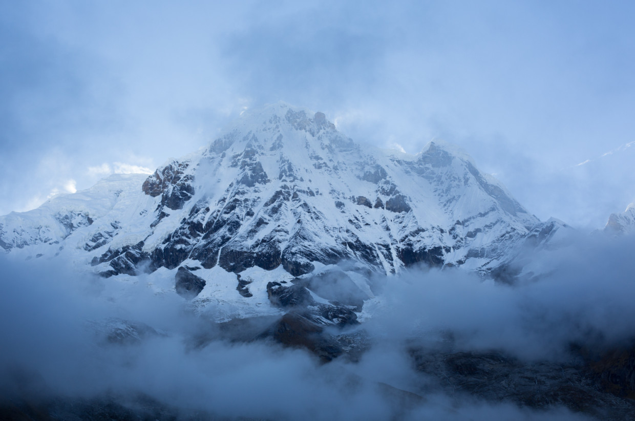
Words and photography: Tom Eagar
One of the great treks of the Nepal Himalaya, the breathtaking scenery of the Annapurna Sanctuary is matched only by its diversity. Trekkers are led through lush forests of bamboo and rhododendron, right into the heart of a high mountain amphitheatre surrounded by the vast peaks of Annapurna, Hiunchuli and Machhapuchhare. For those prepared to climb the many stone steps, this is a rewarding and visually arresting trek.
Situated within the more famous Annapurna Circuit, the Sanctuary trek weaves its way up and down steep green valleys whilst providing all the pleasures of a Nepalese trek: idiosyncratic teahouses, hot meals, and the inescapable sense of scale and awe that comes with walking through the greatest mountain range in the world. All this, whilst escaping the ever-encroaching roads of the Circuit, and the higher altitudes of the Everest region.
My trekking partner and I visited in the low season of mid-September, trading wetter weather for quieter trails and teahouses. Reaching a maximum elevation of 4,130m, the route varies immensely from humid jungles to frosty alpine bowls. The Sanctuary is usually completed in 10 days – which includes the short side trip of Poon Hill, worthy for its spectacular views – but depending on your fitness levels and familiarity to altitude, it can be done in less time if required. The trail follows a roughly circular route, doubling back on itself along the Modi Khola Valley as it leads to and from Annapurna Base Camp (ABC). The earlier days of the trek are more challenging than those leading directly to and from base camp, due to the steep climbs and descents in and out of side valleys.
Day 1: Nayapul (1,070m) To Ulleri (2,020m) – 6hrs
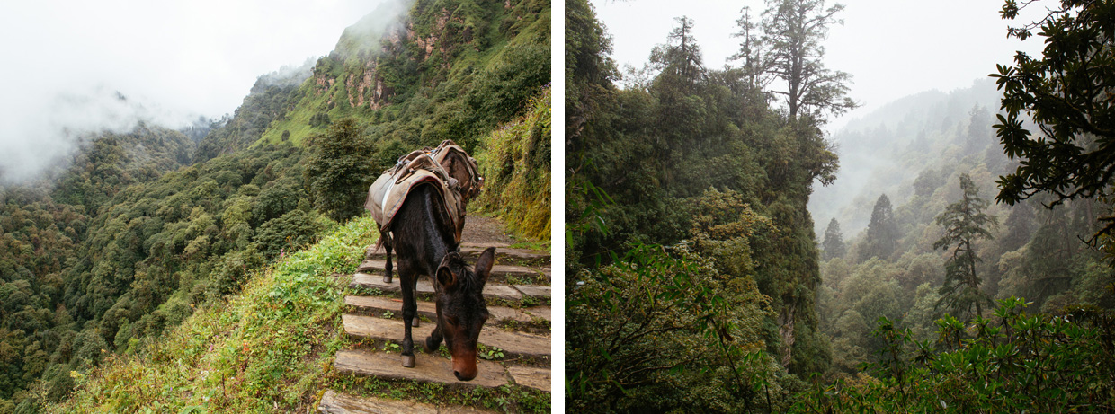
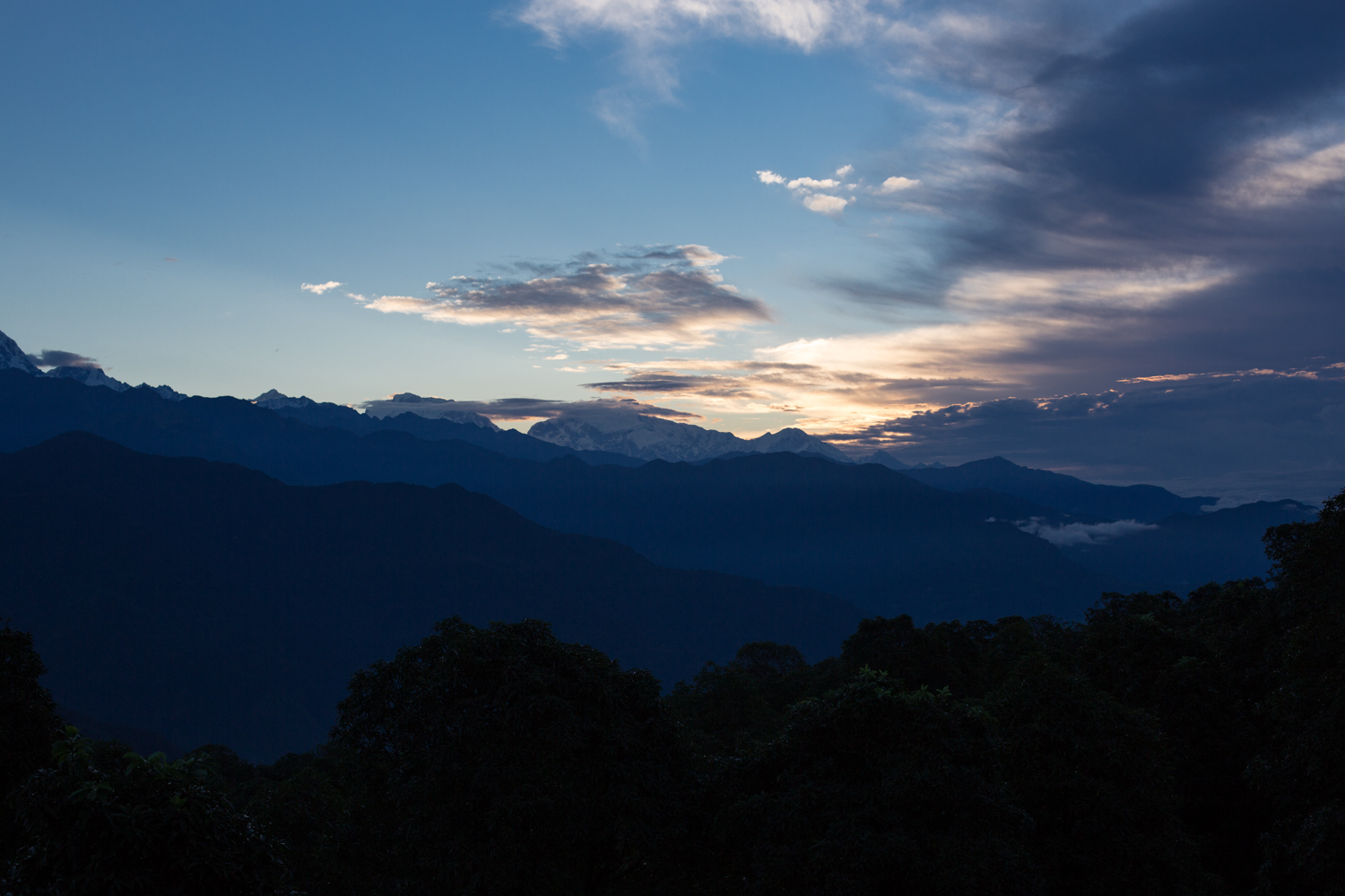
The path leading out of Nayapul follows the Bhurungdi Khola River north-west. Down here the valley is wide and open and farmlands skirt the river. Countless butterflies fill the air as the rich green Himalayan foothills fill our view. Whilst the gradient isn’t yet a challenge, the intense humidity is. The wide gravel road eventually narrows at Tikhedhunga, and we cross the river over a small bridge to begin ascending the 3,000 stone steps that lead straight up the steep west side of the valley to the small hill town of Ulleri. Only foot traffic can reach beyond this point. The combination of heat and gradient is draining, and our home for the night – the Kamala Guesthouse – is a welcome sight as we reach the top, a couple of hours later. As we sit out on the terrace later that evening under a fading pink sky, the clouds to the north briefly part to reveal a teasing glimpse of Annapurna South (7,219m).
Day 2: Ulleri (2,020m) to Ghorepani (2,860m) – 4hrs
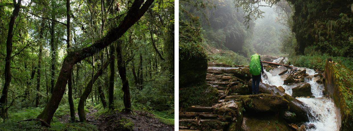
The path out of Ulleri leads through damp, mossy woodland where purple flowers litter the floor. The route briefly cuts back over the Bhurungdi Khola River, the footbridge covered with prayer flags, before resuming its north-westerly direction up the valley. The track then steepens and the sound of the river fades as the forest thickens. Entering the village of Ghorepani, we crest a ridge and are presented for the first time with the view of the Ghar Valley spreading out in front of us. On the far horizon, the snow-covered face of Dhaulagiri (8,167m) stands immense and defiant. Landslides are common here during the wet season and the teahouse we spend the night in is without electricity on account of such a slide 10 days before. After a candlelit dinner with the other trekkers we turn in ahead of our early start for Poon Hill the next morning. As I lie in bed with my eyes closed I can make out the bright flashes of lightning outside our window, and I drift off to the sound of the rain falling heavily on the roof above.
Day 3: Ghorepani (2,860m) to Tadapani (2,630m) via Poon Hill – 5½hrs
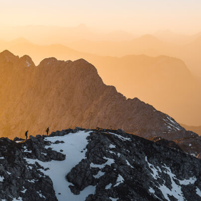
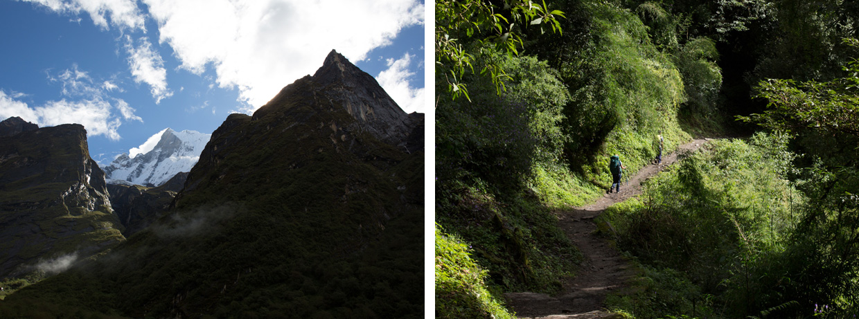
Our alarms buzz at 4.45am. We leave our packs at the teahouse and set off in the dark up Poon Hill. The top of the hill – some 300m above Ghorepani – offers stunning sunrise views over the Annapurna range. As with most early starts such as this, the effort is worth the reward. Even three days in it’s still hard to adjust to the scale of this landscape. When obscured by cloud, I find myself painting a mental picture of where I feel the mountain peaks should be, and then, as the clouds disperse to reveal them, they’re twice as high as I had assumed. Standing on Poon Hill at its already considerable elevation of 3,193m, we’re still around 5km lower in altitude than some of the mountains we’re looking up at. Within that vertical difference alone you could fit Mont Blanc and have room left over.
From Ghorepani the path onwards to Tadapani leads up and over the Deurali Pass (3,090m) and along a verdant ridge. It proves to be one of the most varied days in terms of terrain, as the route weaves though misty rhododendron gardens, meadows of thistle and wildflowers, and thickets of deciduous red-barked trees. The air is fresh and cool.
The path then descends some 600m into a steep gorge. It hugs the side of the gorge and curves around huge Himalayan cedars, whose trunks begin out of sight down below, and end in the mists above. We lunch at a small teahouse at the bottom as Grey Langur monkeys, common around this area, watch us from the trees above.
Day 4: Tadapani (2,630m) to Sinuwa (2,360m) – 7hrs
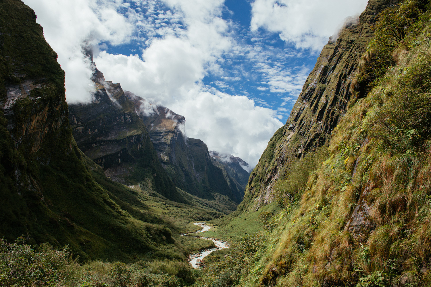
Despite finishing the day only around 300m lower than where it began, day four – like much of the route through these lower valleys – features much climbing and descending. In today’s case, around 1,000m of altitude is lost and then regained. The route finishes the day at the beginnings of the Modi Valley: gateway to the base camps of Annapurna and Machhapuchhare, flanked on both sides by smooth and seemingly endless rock faces. As you enter the mouth of the valley you can’t help but feel you’re stepping into a wholly different type of landscape, one of vast proportions.
The path out of Tadapani divides, and we stick to the shorter westerly route, which comes at the cost of a steep down and up out of the Kimrong Valley. We pass through fields of corn and millet where small blue birds with red tails play in the spray of a small waterfall at the valley bottom. Once up the other side, we stop for lunch at the village of Chomrong. Home to some of the nicest teahouses on the trail (namely Excellent View, Kalpana and International), Chomrong is the highest permanent settlement in the valley and offers stunning views of the surrounding peaks if you’re looking to break up the trek at this stage. During our brief time there, the higher peaks remain obscured by cloud. It’s a strange thought that the vast peaks of this mountain rage – visible from space – are invisible to us just a few kilometres below them.
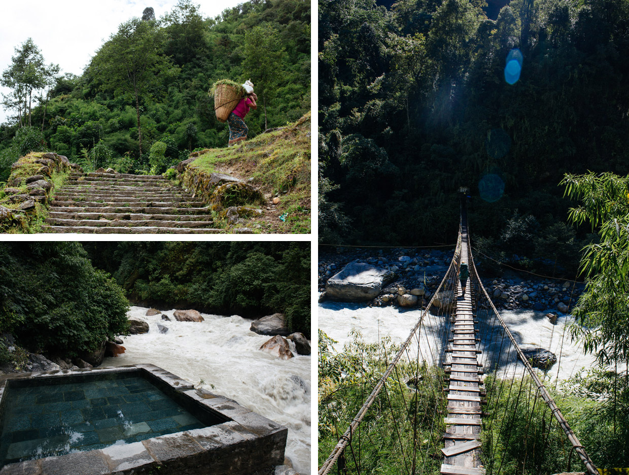
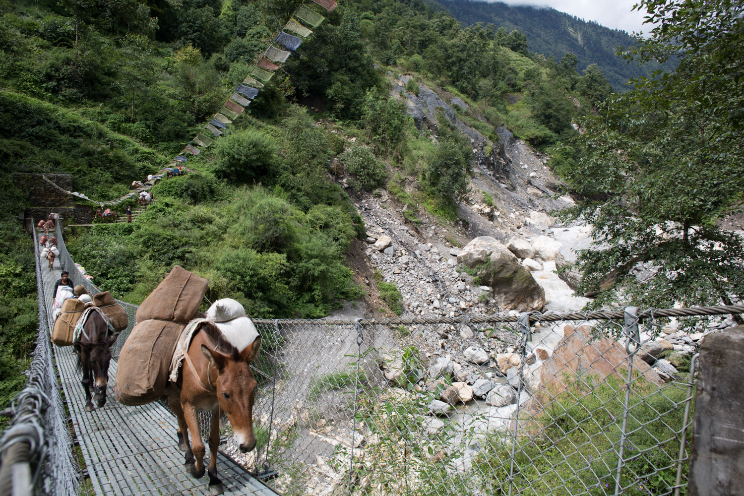
Leaving Chomrong, the trail descends a short way through fields to a long suspension bridge (1,860m) at the valley bottom, before climbing steeply up through forests of oak and bamboo to Sinuwa. Our teahouse for the evening is run by ‘honey hunters’ – a family of locals who scale nearby cliffs, risking their lives to eke out an extra income from the bees they share the valley with.
Day 5: Sinuwa (2,360m) to Deurali (3,230m) – 7½hrs
As we rise with the dawn chorus, the prospect of finally entering the higher mountain range is enough to put any aches from the previous four days at the back of our minds. Pack donkeys, a common sight thus far on the trail, don’t operate above this altitude and any supplies from now on are hard earned by porters. Although dropping down every now and again to cross small tributaries, this section of the trail is mostly about gaining altitude. We press on up the valley, climbing through forests of rhododendrons and ferns, the trail loosely following the path of the Modi Khola River, which starts life some 12km up valley in the East Annapurna Glacier.
The day is a long one, and takes place mostly beneath a canopy of bamboo. We take refuge from the afternoon’s heavy rain under a large overhanging rock known as Hinku Cave, named after the small hotel it used to house. From this vantage point we’re treated to our first sight of Deurali. Kissing the treeline and half obscured in mist, it’s dwarfed by the rock faces either side of it that climb up into the clouds, and the cascades of water that tumble down them. We press on, passing between huge boulders and over fast-flowing tributaries. Upon reaching Deurali’s Panorama Guest House, I notice extra mattresses stacked high in the corner of the dining room, ready and waiting to accommodate the influx of high-season trekkers when demand exceeds the available bedrooms.
Day 6: Deurali (3,230m) to Annapurna Base Camp (ABC) (4,130m) – 3½hrs
We keep the tumbling glacial river on our right as the valley widens and the gradient eases. There’s no denying we’re now entering the high mountains. The trees we’ve become so accustomed to quickly give way – first to small shrubs, and then a meadow of blue and yellow wildflowers as we approach Machhapuchhare Base Camp (MBC, 3,700m). In winter, this section of the trail is particularly susceptible to avalanches from Hiunchuli’s steep slopes above, at which times crossing over to the east side of the river is strongly recommended. If trekking in winter, check with Deurali lodge owners before continuing.
As we approach 4,000m, the altitude begins to make itself known and our packs feel heavier, our steps more laboured. My hands begin to tingle. MBC sits at the head of the valley and is the last camp before the path cuts 90˚ westward up the glacial basin in which Annapurna Base Camp sits. In an effort to acclimatise and minimise the effects of altitude, some trekkers opt to spend the night at MBC and complete the 430m climb up to ABC in the small hours to catch the dawn light, before returning back to MBC for lunch, and continuing down the valley later in the afternoon.
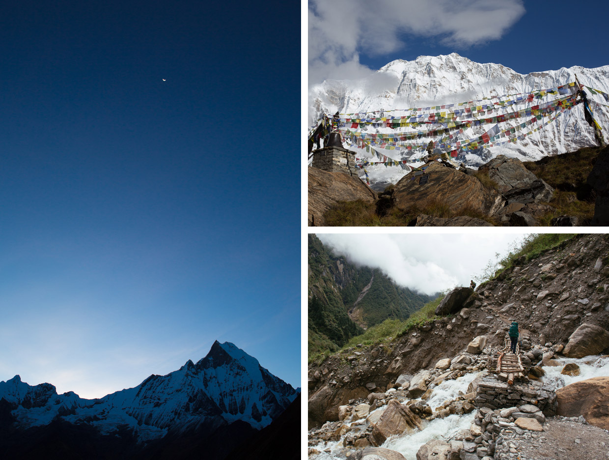
Both camps are free of snow at this time of year, and the valley floor is a wide, open mix of grass and exposed rock. The morning’s clear skies disappear as a thick mist follows us up the valley; by the time we reach ABC visibility is down to a matter of feet. Frustration is avoided, however, when the clouds begin to part just before sunset and we’re granted our first astonishing panorama of the Annapurna range that encircles us.
Day 7: Annapurna Base Camp (4,130m) to Bamboo (2,310m) – 7hrs
It’s a restless night’s sleep at high altitude, but the draw of a cloud-free sunrise is too strong, and we’re up by 5.45am. A few minutes later we join other trekkers as they stand bleary eyed at the lip of the South Annapurna Glacier, a short walk from ABC’s teahouses. The sky is a deep blue and the air is crisp. As the sun’s rays begin to spill over the ridge of Machhapuchhare to the east, the face of Annapurna is slowly illuminated in a delicate alpenglow. The morning light reveals the nuances of its snow-covered spines, casting shadows in between its ridges, adding ever more depth and detail to the scene. Standing in that vast mountain amphitheatre, in the shadow of the tenth-largest mountain in the world is a humbling experience, and one that I’m certain will leave an indelible mark on the memories of those lucky enough to experience it.
As we retrace our steps back down the valley later that morning, we descend almost 2,000m. The difference in altitude brings a welcome change to our breathing and energy levels. Trees reappear, and with them the sound of crickets and the sight of butterflies. Bamboo camp sits about halfway between Sinuwa and Deurali, nestled amongst the trees from which it takes its name.
Day 8: Bamboo (2,310m) to Jhinu Danda (1,780m) – 6hrs
The path divides after a tough climb back up to Chomrong. We follow the easterly trail that zigzags steeply down a narrow rocky track to the settlement of Jhinu Danda, which sits on the tip of the side valley. The small settlement offers a clear line of sight back up the Modi Valley towards Sinuwa, and also southwards, across the endless green slopes of the Himalayan foothills.
Despite the highlight of the trek now being behind us, the Sanctuary still has some surprises up its sleeve. At Jhinu Danda, that comes in the form of geothermal hot springs tucked into the banks of the Modi Khola River, a 20-minute walk down from Jhinu Danda. After more than a week on the trail, this is a welcome proposition. With dense jungle canopy silhouetted against the darkening sky above us, and the sound of fast-flowing waters just a few feet away, the warm spring waters soothe our weary muscles.
Day 9: Jhinu Danda (1,780m) to Pothana (1,890m) – 8hrs
A clear morning grants a view of Annapurna South’s peak (7,219m), a white jewel poking out above a sea of green forest. We press on southwards down (and then up) a waterfall-laden side valley known locally as the Kladi Khola. Above us, building work is taking place to span a footbridge across this gap. When finished, it’ll be the second longest on the trail. Just beyond, we pass through the aptly named village of New Bridge (1,340m) and the path cuts over to the east side of the valley and works its way through ferns. The lush, near-vertical cliff face now directly to our left throws us into welcome shade.
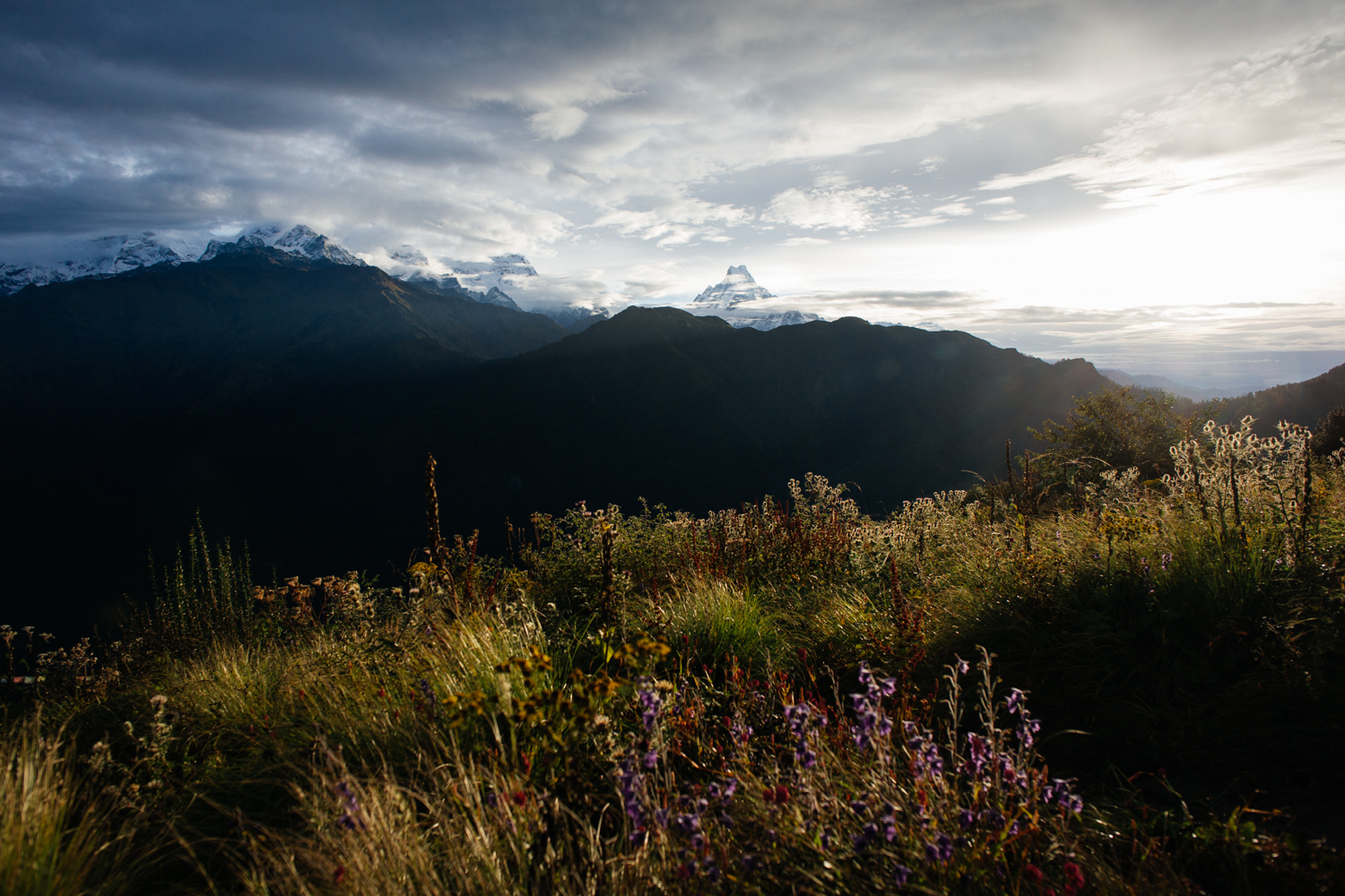
Past the cliffs, the path climbs up the jungly east side of the valley to Landruk, a good lunch spot with fine views of Annapurna South. From here the path eventually widens into a stony single-track road that hugs the hillside, and weaves along at a fairly level altitude for the rest of the day, passing through the small settlement of Tolka (1,790m). As we near Pothana, the grey rocky earth morphs into a rich red clay. From here it’s a short walk down to Kande, one of the possible finishing points of the trail. Pothana sits right on the treeline and offers a view that encompasses the entire Annapurna range along with the great wall of the Himalayas as it disappears off into the eastern horizon.
Day 10: Pothana (1,890m) to Kande (1,770m) – 1½hrs
The final walk down to Kande is notable only for its gradual descent back to civilisation. Houses and smallholdings begin to fill the sides of the trail, replacing trees and bluebell-like flowers. Eventually the path emerges without fanfare back onto the main road that we initially departed 10 days previously.
Those willing to embrace the altitude, the steps, and the constant up-and-down character of the Annapurna Sanctuary will be rewarded with lasting memories of good-natured locals, comfortable teahouses, varied and lush landscapes, and the unmatched wonderment that comes from spending time walking through one of the most spectacular landscapes in the world.
High Season – October to November
Shoulder Season – March to April
Low Season – June to September
Pokhara is the closest and best-equipped town from which to begin treks in the Annapurna region. Here you can book transport and guides, and pick up any necessities.
A return taxi to the trailhead costs around $25 (2500NPR). Depending on your budget this may be preferable to the much cheaper bus, which leaves from Pokhara’s Baglung bus station and takes roughly 1½hrs to Nayapul, which is also the pick-up point for buses back to Pokhara.
Before setting foot on the trail, you’ll need a TIMS Card and an ACAP Trekking Permit ($20). These can be purchased at the office of the Nepal Tourism Board, either in Kathmandu or Pokhara. Keep these – along with a good map (see Himalayan Map House) – in a dry bag for the duration of your trek. Some of the villages you pass through have checkpoints that you’ll be required to register at.
Money – Take enough cash for how many days you expect to be on the trail. $15-25 (2000-2500NPR) per day is a good guide; this includes three hot meals a day and accommodation.
Guides and Porters – Whilst by no means essential, some working to a bigger budget may prefer to trek with a guide ($25 per day) or porter ($15 per day). The Annapurna Sanctuary can certainly be completed without either. Both can be arranged in Pokhara.
Food – Dal bhat is a traditional Nepalese lentil soup that is served everywhere. Unlike other meals, it comes with unlimited refills. Useful for big appetites brought on by trekking.
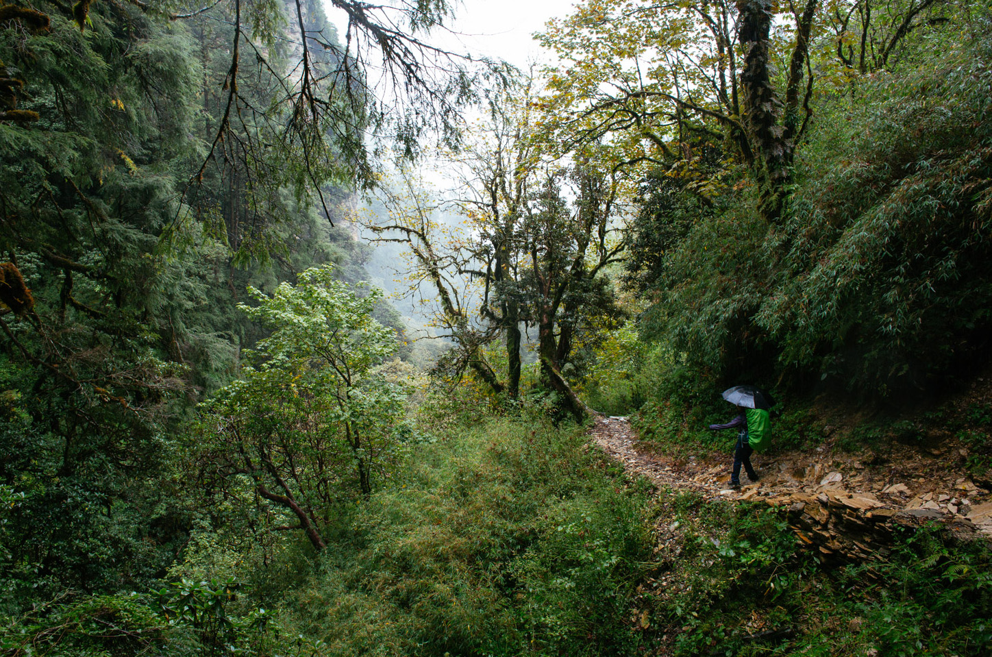
Kit – Aside from waterproofs and extra layers for the higher altitudes, water-purification tablets are a useful addition along with a good book for long evenings in teahouses. A small, lightweight umbrella is a common sight amongst the guides on the trail, and can provide welcome respite from heavy rains and intense sun. A sleeping bag liner will suffice for most nights, but a sleeping bag will prove useful for Annapurna Base Camp.
Altitude – Familiarise yourself with the symptoms of altitude sickness (which include headaches, nausea, and severe fatigue). It affects people to different degrees, regardless of fitness. Stay well hydrated and descend to a lower altitude if symptoms intensify. Once above 3,000m, don’t ascend more than 500m per day.
Full disclosure – Tom and Emily were helped on their trek by Poler Stuff and howies, and guided by Umesh Acharya of The North Face Inn, Pokhara.
Tom Eagar is a freelance filmmaker and photographer, specialising in documentary, adventure travel and lifestyle content. His written and photography work has been published in a variety of travel and culture publications including Boat magazine, Huck and MPORA. He’s currently based in Queenstown, New Zealand.
Website – tomeagar.net
Vimeo – vimeo.com/tomeagar
Twitter – @eagar_tom
Instagram – @tomeagar