Planning an Arctic sea kayaking expedition
Survive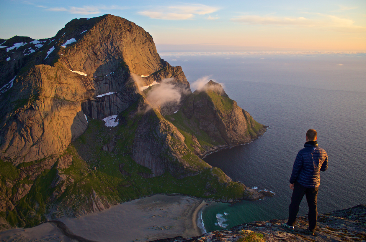
Planning is everything, the plan is nothing. Sea kayak expedition leader Kristoffer Vandbakk, based in Norway, explains how to plan and execute a sea kayak journey along an exposed and isolated coastline.
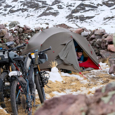
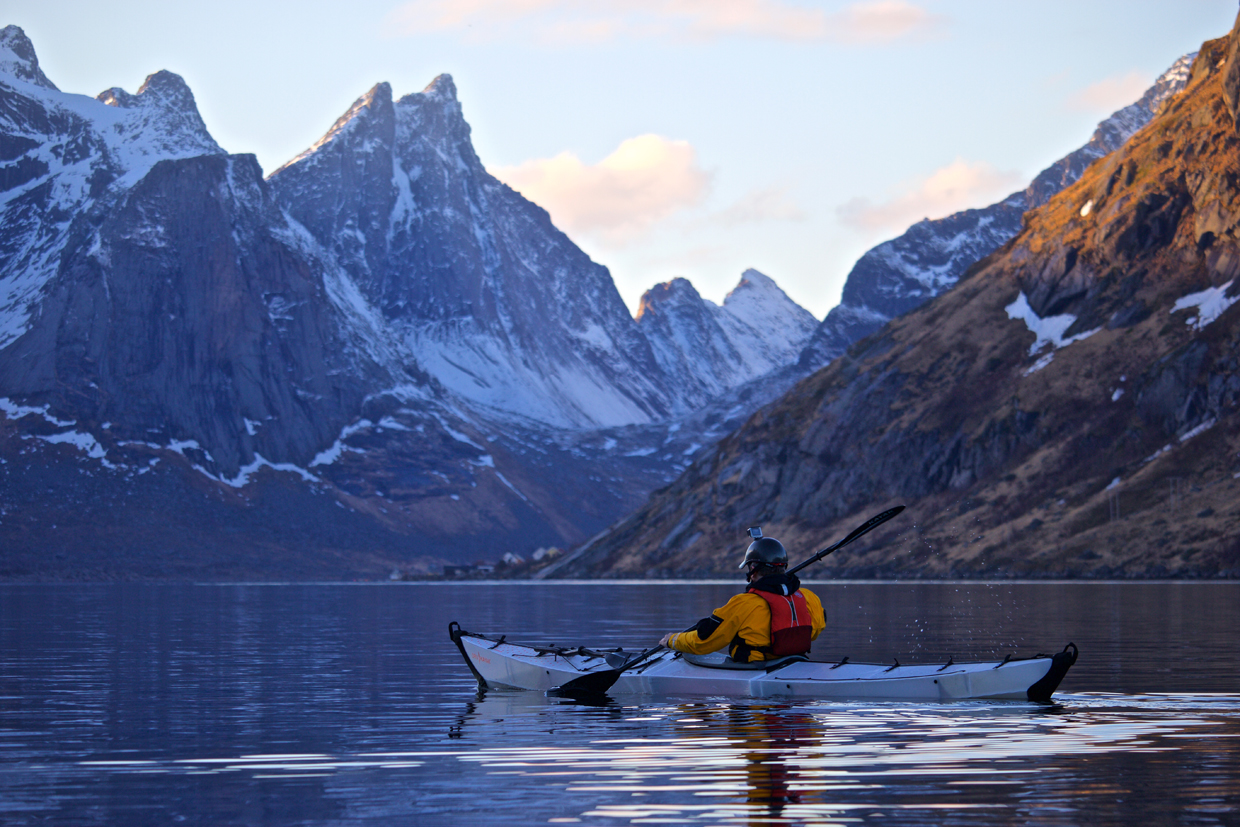
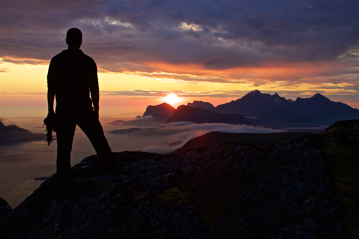
How do five days on a remote coastline above the Arctic Circle sound as an adventure? Add on tidal currents, isolated beaches, steep mountains, midnight sun, a sea kayak and you have the recipe for deep outdoor experiences. The Lofoten archipelago in Northern Norway is exposed to the Norwegian Sea and the rapidly changing coastal weather so typical for these islands.
How can you safely execute such a sea kayaking trip? Can you identify the risks and eliminate them all? This article works through relevant risks to arrive at a plan. The methodology used for this location can be applied to other sea kayaking journeys, but it is not a definitive guide, more an attempt to illustrate how to apply a conceptual model.
One of the Lofoten islands offers a challenging sea kayaking adventure like few others. The Moskenes Island’s isolated west coast is unique and dramatic: sea caves, dry caves, fabled tidal currents and rich wildlife above and under the ocean surface. The handful of families living there moved to the sparsely populated east coast in the 1950s, as the introduction of electricity and technology made a more isolated existence far less attractive. The locals call the unpopulated western coastline the ‘outer side’ and the little-populated east coast the ‘inner side’. There are no roads or settlements on the west coast and the island is divided by 1,000m-high mountains, making a traverse only possible at certain places.
PLANNING
You have total control over one thing, information. Some you have already, the rest you need to research.
You already possess information about the following things:
– Personal skills. Are you prepared? If in doubt you should upgrade your skills by further educating yourself in sea kayaking, navigation and general outdoor skills.
– Equipment. Do you have the necessary camping and sea kayaking equipment?
When you can answer yes to the above, move on to the following:
– Historical weather, wind direction, wave height and temperature data are available online. Check weather statistics relevant to your planned journey and form an idea of what you are likely to encounter.
– Weather. The statistics for the last four years show that the average temperature during the relevant time of year is 14 degrees Celsius. It will be colder at night, but on the coast the difference between day and night temperatures is less dramatic than it is inland. You now have an idea of what sleeping bag and clothes to bring. The average wind speed is 5m/s and the most prevailing wind direction is northerly (57%). The least prevailing wind is easterly at 9% with westerly at 16% and southerly at 18%. That should give you a good idea of the best direction in which to travel.
– Campsites. Use Google Earth, maps, hiking guidebooks or online research to find suitable camping sites. Your priorities should be safe landing spots for a sea kayak, drinking water, possible escape routes on foot, communication by phone or VHF and, lastly, comfort. Local regulations for camping, bird nesting season restrictions and use of open fire should also be understood. Local knowledge from others who have been there before is invaluable. Keep in mind that no source – human, internet or otherwise – is perfect. It’s about getting as much information as you can and understanding you will never be 100% certain about what you’ll find.
Google Earth can be great for campsite-spotting. Perhaps you’ll find a beach that looks spectacular with a fresh water stream at the southern end. An escape route to human infrastructure is possible to the south-east; the beach is, however, facing north-west. Prevailing wind direction is from the north. A strong wind from the north-west is likely to form surf at this beach making landing and launching a sea kayak challenging. If such conditions occur you could end up choosing to avoid this beach entirely.
– Tide. Information about tides are available in tidal atlases, pilot guides or by Googling the topic online. This can be difficult when this information is not available in English. Another option is calling or writing to the national pilot guide organisation, or alternatively you could contact local sea kayakers or sailors. As a sea kayaker it can be a challenge getting good tidal information. Most published products are designed for ships or boats, and they don’t always have accurate information very close to shore where sea kayakers typically operate.
– Risk assessment. Describe known risks, how to avoid them and how to deal with them should they occur. Be honest and keep it simple. You may find out that some risks are too high and that a serious effort to avoid them is necessary. Outline all known risks and form measures to avoid and deal with these risks should they occur.
– Cultural and historical information. You may be surprised at how much relevant information you can find by soaking up some cultural and historical atmosphere. Read up on the place. Again the internet is a great source.
Having gathered necessary information and made a day-to-day plan, you are ready to execute it to the letter and without any hiccups – but you’ll most likely find that the real world will delay, obstruct and obsolete parts of your carefully assembled plan. You may find that risks you never considered are more significant than the ones you have planned for, and risks you have planned for may never present a threat. For instance, I have planned for high winds, fog and rain only to find myself risking sunburn due to unusually fair weather. Your planning will however make your execution easier, safer and more enjoyable than if you did not have one. Review your plan after you arrive back home. Learn from the experience, add new aspects to your next plan and become a better planner in general.
EXECUTION
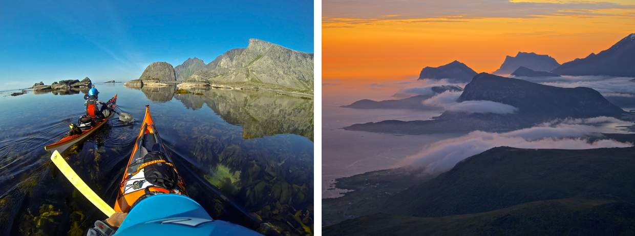
When I’m leading this expedition, we typically begin this trip from the small village of Fredvang, north on the island. The first leg of the journey is about 10km and takes us to the Kvalvika beach. This beach became well known in the documentary North of the Sun, which is about two surfers who wintered there in a shelter built from debris found on the beach. It’s worth being aware of the Bergsneset headland before Kvalvika. Clapotis due to the steep mountains and tide may create demanding conditions for some paddlers.
Near this beach there are several sea caves to explore. One has large pebbles in it, filling the cave with dramatic sound as waves wash in and out. Most people do not venture far into this particular cave when they hear the sound of grinding pebbles echoing within.
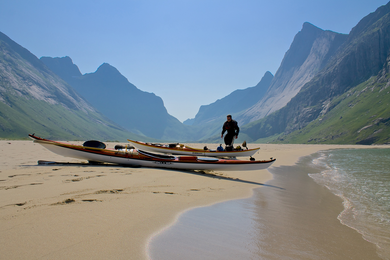
There are two huge sandy beaches along the coast with fresh water and excellent wild-camping spots, cradled by steep smooth granite walls. The Bunes beach was inhabited by the Bunes family up until the Second World War when a stranded mine blew up one of the houses there.
The stretch from Bunes beach to the southern tip has several dry caves. The Refsvika cave requires a certified guide to accompany you as it has several old cave paintings that are protected. About 3-4,000 years ago there existed a cave religion in Lofoten. The caves held cultural significance, and similar cave paintings – often depicting what look like stick men – can be found in caves on other islands as well. A few of the caves face north-west which means that they are only illuminated by the midnight sun, which lasts from May 26th to July 17th.
At the southern tip of Moskenes island lies the Mosken tide race. This tide race forms as a large body of water moves over a shallow and narrow strait between Moskenes Island and the smaller Mosken Island. When conditions are gentle it will not form a challenging tide race, but given enough wind and waves, conditions can become treacherous in this strait. Close to land the current is weaker – at the right time and with the right conditions you can safely paddle around the southern tip. According to the Norwegian Pilot Guide, the typical maximum speed is 6 knots in the Mosken tide race. As with all tide races you need to know what you getting yourself into.
Coming down the west coast and around the southern tip lets you contact civilisation by telephone or radio for the first time in days. The east coast of Moskenes is sparsely populated with small villages. One of the most picturesque areas is the Reine fjord which has been featured in countless photos. My tip for any photographer is to wait until sunset or sunrise on a windless day with clear sky. You’d have to be lucky with the weather though as such conditions are rare.
Weather
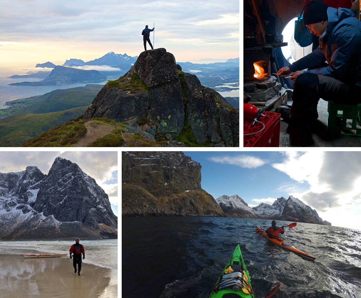
This journey can take three to five days depending upon how much time you have available. During this voyage you will expose yourself to the typical coastal weather above the Arctic circle. Conditions can change fast and sea fog is likely. Weather planning is crucial before setting out in your sea kayak, but a 20-minute hike from Bunes beach will allow you to check weather on your phone or VHF. This is the only spot with VHF or phone coverage on the west coast; the entire east coast has signal.
Wind from the north-west is the least favourable direction for anyone on the west coast. Waves will have a long fetch and there will be few if any lee shores or hiding spots. With a north-westerly wind the beaches are likely to experience surf as well.
Having said all this, the weather during the summer months is much gentler than winter weather – and you’ll have the added challenge of greatly reduced daylight hours during the colder months too.
Wildlife
Lofoten is well known for its abundant sea life and fishing industry. Migrating cod amass from the Barents Sea to Lofoten during the early winter months to spawn. For more than 1,000 years, Lofoten has attracted fishermen from far away to harvest the abundance at this time of the year. You are likely to spot many sea eagles, cormorants and puffins in the more remote areas. Otters and grey seals are shy but spread out all over the Lofoten islands. There are a few resident pods of orcas in Lofoten throughout the year, but you’d be very lucky to spot them. You are more likely to see migrating orcas during the winter months.
Risk
Long stretches on the west coast have no landing spots or walk-out routes, so factor this in to your risk assessment and safety plan using the information sources mentioned above.
The weather is a major concern. It could leave you stranded on one of the beaches or prevent a paddle around the southern tip of the island. Any plan should allow for a delay of a day or more in case of rough weather.
Having paddled the west coast several times and guided people there, I always feel thrilled paddling around the first headland and looking down the craggy, remote and wild coastline. It is rarely visited by humans and I cannot help but feel privileged being there in my tiny craft among mountains, caves and tidal currents.
Keep up with Kristoffer on Instagram @kristoffervan