
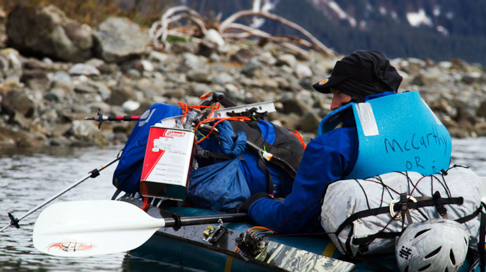

There is a strong temptation in Alaska to fly into remote areas to experience raw wilderness. But it is more rewarding to access that same wilderness without the flight- finding the nearest road or commercial airport and connecting the dots. Part of my motivation is to save money, but mostly I want to see more of the landscape- especially the transition to and from massive peaks. This traverse was planned as 390 km, turned into 600 km, and took 30 days, self-supported. The team was Joshua Foreman, Graham Kraft, Josh Mumm, Luc Mehl, and John Sykes, all of Anchorage, Alaska.
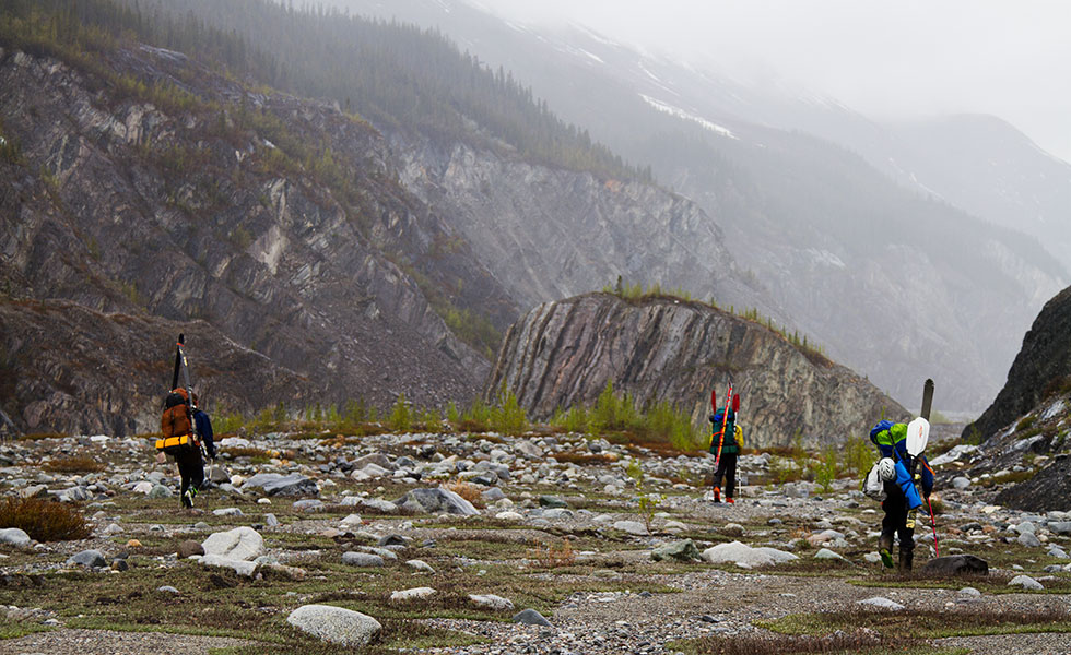
We fly with frequent flyer miles to Yakutat (5$ each). The plane lands on dry tarmac, but it is hailing by the time we get to the baggage cart. This turns out to be typical weather for the first week. We are met by Fred, an amazing guy that Graham met passing through town last year. Fred’s cargo van is unavailable because it got converted into a kennel. This explanation is not quite satisfactory because his blazer is also converted into a kennel- filled with cat food, trays, and hair. We’d convinced 6 friends to join us for the first week of paddling but they don’t have skis and have a fairly miserable slog, post-holing through the snow, in the pouring rain.
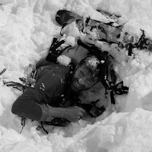
After three days in the water our friends turn back toward Yakutat and we continue to the moraine. There is a break in the rain and we collect enough wood from avalanche debris to build a big fire to dry our stuff, a major morale boost. The next day we haul gear to the ice and make some progress on the glacier. It rains all day and we are soaked again. Graham can wring water out of his sleeping bag. We spend three days in the tents needing the rain/snow to stop. Rain during the day, snow at night. 1.5m of snow accumulates. It breaks, as forecast, and we all rush out of the tents to marvel at the incredible mountains that are now visible. We make good progress, ~24 km per day, pulling our load in the inflated boats. The days are sunny and everything dries out, except maybe our food. Each day the snow firms up and gets easier to travel. We arrive at the East Ridge of Mt. Logan too far behind schedule to run a cache along the south side. We will try to climb the route double-carrying all our gear up and over. There is another group of climbers there. When I see that they are on snowshoes I assume they are clueless, which turns out to be true; they told the Canadian NP that we stole their cache, but then realized that it was further down the glacier.